| Category: Community Services |
Box 134
Sargent, NE 68874 |
| 308-215-0437 |
Sargent Municipal Airport serves as a gateway that
welcomes commerce, tourism, and visitors into the region and provides
access for the citizens and businesses of the Sargent area to travel
outward to the economy at large. General aviation allows visitors,
business travelers, hunters, and fisherman to reach destinations without
the delays and uncertainty of today’s airline flights.
The presence of an airport creates benefits for a community in other ways. Airports bring essential services, including enhanced medical care (such as air ambulance service), support for law enforcement and fire control, courier delivery of mail and high value parcels, crop dusting and aerial applications. Special events such as car and antique shows can be held on the taxi ways and paddock areas. While antique, model, or special event airplane shows can be held on the runways. These services raise the quality of life for residents and maintain a competitive environment for economic development.
During a winter storm in 1986 a Kearney Air Ambulance crashed and our very own airport was used as a hub for the search and rescue for that helicopter.
The benefits from a municipal airport are great while the tax burden is low. Believe it or not, small airports are funded through the FAA from a tax on aviation fuel and airline ticket sales. These taxes are put into a fund from the FAA for small municipal airports in our country.
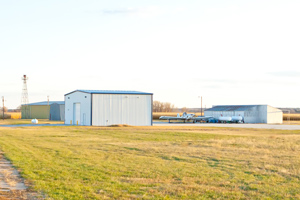
Sargent Airport has finished construction on a new hangar with a pilots lounge. This new storage area will house snow removal equipment and other items used to up keep the airport. At this time the Sargent airport will accomodate small aircraft and twin engine aircraft. Coming Soon... the airport will be widened 10 feet and a 1,000 feet of runway allowing small jets to enter our area.
Congratulation to John Troxel, Chairman of the Sargent Airport Authority and all its members for receiving a 98% on the Pavement Condition Index Survey from the Nebraska Department of Aeronautics. PCI Survey in PDF
| FAA Identifier:
|
09K
|
| Lat/Long:
|
41-38-13.0230N / 099-20-25.3730W
41-38.217050N / 099-20.422883W
41.6369508 / -99.3403814
(estimated)
|
| Elevation:
|
2313 ft. / 705.0 m (surveyed)
|
| Variation:
|
08E (1985)
|
| From city:
|
1 miles East of Sargent, NE
|
| Time zone:
|
UTC -5 (UTC -6 during Standard Time)
|
| Zip code:
|
68874
|
| Ownership:
|
Publicly-owned
|
| Owner:
|
Sargent Airport Authority
P.O. Box 134
Sargent, NE 68874
308-215-8078
|
| Manager:
|
John Troxel
P.O. Box 134
Sargent, NE 68874
308-215-0437
|
| Airport use:
|
Open to the public
|
| Activation date:
|
02/1950
|
| Sectional chart:
|
Omaha
|
| Control tower:
|
No
|
| ARTCC:
|
Denver Center
|
| FSS:
|
Columbus flight service station
|
| NOTAMs facility:
|
OLU (NOTAM-D service available)
|
| Attendance:
|
UNATNDD
|
| Wind indicator:
|
Yes
|
| Segmented circle:
|
No
|
| Lights:
|
DUSK-DAWN ACTVT MIRL RY 16/34 - CTAF
|
| Beacon:
|
White - green (lighted land airport)
|
| Aircraft based on the field:
|
3
|
| Single engine airplanes:
|
2
|
| Ultralights:
|
1
|
| *Local general aviation:
|
68%
|
| *Transient general aviation:
|
32%
|
| *Average for 12-month period ending 30 July 2008.
|
| Dimensions:
|
3000 x 50 ft. / 914 x 15 m
|
| Surface:
|
Asphalt, in excellent condition
|
| Runway edge lights:
|
Medium intensity
|
| Runway 16 traffic pattern:
|
Left
|
| Runway 16 Markings:
|
Nonprecision, in good condition
|
| Runway 16 Obstructions:
|
25 ft. road, 600 ft. from runway, 24:1 slope to clear
|
| Runway 34 traffic pattern:
|
Left
|
| Runway 34 Obstructions:
|
None
|
Location
| Board Member:
|
Tim Leibert
|
| Board Member:
|
Randy Caryl
|
| Board Member:
|
Marilyn Kolar
|
| Board Member:
|
Guy Schlachter
|
There are no published instrument procedures at 09K.
Some nearby airports with instrument procedures:
KBUB - Cram Field Airport (12 nm NE)
KODX - Evelyn Sharp Field Airport (17 nm E)
KBBW - Broken Bow Municipal Airport (18 nm SW)
KLXN - Jim Kelly Field Airport (54 nm S)
KCZD - Cozad Municipal Airport (55 nm SW)
| CTAF:
|
122.9
|
WX ASOS at ODX
(17 nm E):
|
119.925 (308-728-7954)
|
WX ASOS at BBW
(18 nm SW):
|
120.0 (308-872-5354)
|
| VOR Radial/Distance:
|
CUZ r052/18.1
|
| VOR Name:
|
CUSTER COUNTY VOR/DME
|
| Freq:
|
108.20
|
| Var:
|
08E
|
|
NDB Name
|
Hdg/Dist
|
Freq
|
Var
|
ID
|
|
Burwell
|
220/12.0
|
377
|
07E
|
BUB
|
|
Ord
|
266/17.6
|
356
|
07E
|
ODX
|
|
Broken Bow
|
039/18.0
|
265
|
08E
|
BBW
|
| Parking:
|
Hangars and tiedowns
|
| Bottled oxygen:
|
None
|
| Bulk oxygen:
|
None
|